 |
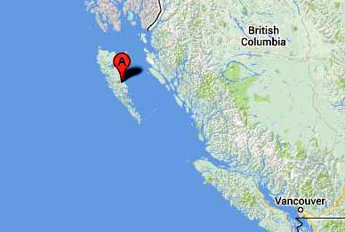
| Alliford Bay is located on Queen Charlotte Island. (Map courtesy Google Maps) |
ALLIFORD BAY, BRITISH COLUMBIA (1941 -1943)
|
| Alliford Bay is located on Queen Charlotte Island. (Map courtesy Google Maps) |
Alliford Bay, originally built as a Royal Canadian Air Force (RCAF) seaplane air base, operated during World War II. From 1941 to 1943, HFDF capabilities were at the disposal of the Royal Canadian Navy. RCN complement was probably four to six operators. The base was shut down after the war, and the community of Alliford Bay gradually evolved into a logging centre.
 |
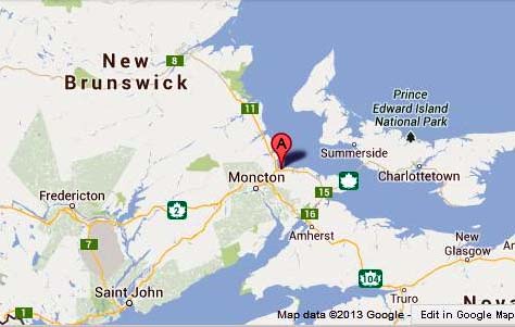
| Chelsea, Quebec. (Map courtesy Google Maps) |
Of the fifteen or so military radio sites that existed in the Ottawa area during World War II and post-war periods, the naval radio station at Chelsea is perhaps the least known. It was located on the north side of Old Chelsea Road a few hundred yards west of Highway 105. Chelsea is a small village about five miles or so north of Ottawa with the population of Chelsea almost evenly divided between Anglophones and Francophones. Both English and French are in common use throughout the village.In Canada, a modest beginning to propagation research was made by the National Research Council during the 1930s, but wartime requirements for communications over circuits not previously established and to mobile units at sea and in the air resulted in a substantial expansion and acceleration of that work. At the request of the Royal Canadian Navy, and to support its anti-submarine campaign, an extensive study of the conditions affecting the transmission of radio waves was initiated. An ionospheric sounder was installed at Chelsea, Quebec, in 1941 by F.T. Davies to measure the critical frequency and the height of the reflection of radio waves from the ionosphere. Because the reflective properties change with time of day, season and sunspot cycle, up-to-date measurements were of great value for estimating the best frequencies for medium and high frequency communications. Such information was also of advantage in determining some of the details of transmission from distant hostile stations. Of particular importance was the need to assess and, if possible, forecast intervals of ionospheric disturbances during which communications were disrupted.
With the increase in the use of radio by both sides during the war, a need developed a need to understand how communications could be affected by the ionosphere, that layer in the upper atmosphere capable of bouncing radio signals back to the earth's surface. More specifically, the Navy wanted to understand how the propagation of radio waves was affected by the ionized layer and how that layer could be used to intercept enemy signals in a more efficient manner. In co-operation with the National Research Council, the RCN established a "field intensity station" at Chelsea in 1941 to monitor ionospheric heights in a project called PF. (That might have been a code word). Chelsea was also known as an ionospheric observatory.
Remembrances by a Radio Scientist" by Jack Belrose offers some comments on Chelsea ."With National Research Council assistance ionospheric equipment was built and installed in 1942 at the first Canadian ionospheric station at Chelsea, Quebec. It was manned by RCN signallers trained by OIC/6. This station was moved to a small building on the Experimental Farm which was released by the RCN.
In 1943, a second RCN ionospheric station was set up at Churchill, Manitoba, in a hut belonging to the Harbour Board. This station was again manned by RCN signalers and directed for two years by R.E. Freeman of NRC. In 1944, the Department of Magnetism of the Carnegie Institution of Washington established an ionospheric station at Clyde River on Baffin Island. This station was taken over by the Department of Transport two years later, and extra stations were established by DOT at Chimo, Quebec, Baker Lake, NWT and Resolute, NWT. The RCAF established ionospheric stations at Torbay, Newfoundland and Portage La Prairie, Manitoba, while the Canadian Army set up similar stations on Signal Hill, Prince Rupert, B.C".
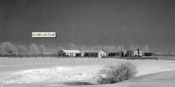 |
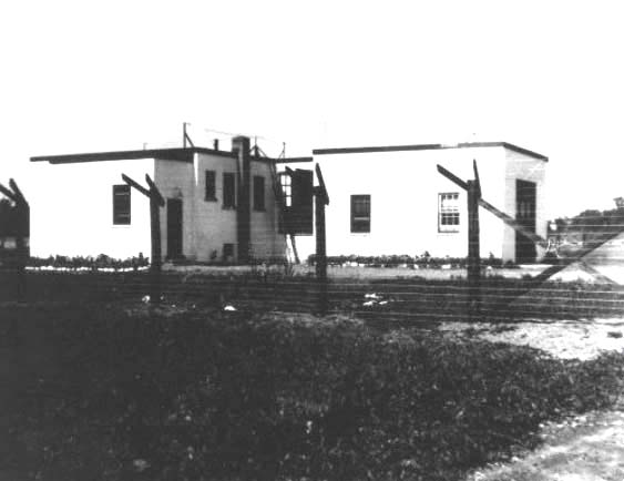
| This was the RPL Laboratory at Chelsea but is now demolished. Once source has the photo as being located at Chelsea while another places it on the Experimental Farm in Ottawa. If anyone can confirm the location, please contact Jerry.proc@sympatico.ca (DRTE/CRC Image Collection Image 51-RPL-0173) |
The Chelsea station operated during the post war period but in 1947, its work was transferred to the Defence Research Board's new Radio Propagation Laboratory in Ottawa. Shortly thereafter, the station was demolished. Today, there are no traces of the single shack or the many masts that were once erected on the property.
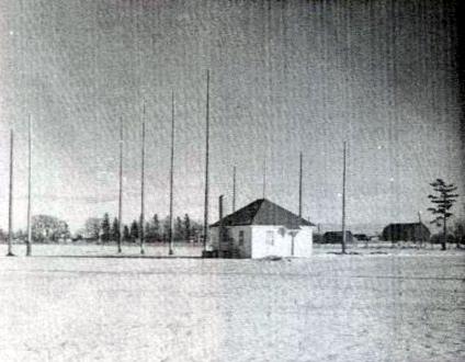 |
| The former research station at Chelsea, Quebec. Despite its important role in ionosphere studies, there wasn't much there to see. (Photo: National Archives, PA-177693) |
The municipality has a reputation for being environmentally responsible and was one of the first in Canada to ban the use of pesticides. It was once known as Hull-Ouest or West Hull, but the name was changed to avoid confusion with the neighbouring city of Hull (now Gatineau). Additional information about the Chelsea station can be found in a story by Carol Martin. It appeared in Volume 28 of the Gatineau Valley Historical Society newsletter.GRANDE PRARIE, ALBERTA
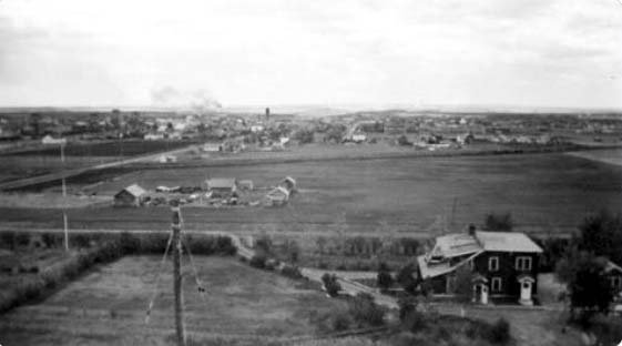
The Grande Prairie station was located northwest of Edmonton. (Google Maps) #2 Special Wireless Station, Grande Prairie, Alberta, was an Army intercept site which operated from 1942 to 1947. The site, now dismantled, is occupied by seniors housing. (Photo provided by Bill Robinson) In a letter to the Secretary of National Defence, dated Aug 26/46, the following equipment is being reported as being on strength.
24 Hammarlund SuperPro receivers
2 Marconi CSR-4 receivers
1 Hallicrafters receiver (model # not noted)LAMBETH, ONT
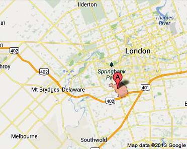 |
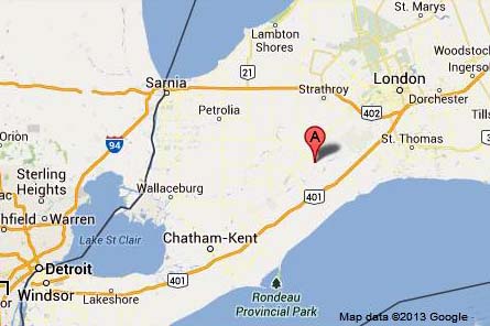
| Lambeth relative to London, Ontario. (Map courtesy Google Maps) |
Researcher Bill Robinson, provides information about the Lambeth station after speaking with a member of the Westminster Historical Society. The society had some clippings of local press coverage of the station in 1988 and a handwritten (although unfortunately unsigned and undated) letter from a former radio operator at the station describing the work there. Lambeth is now part of London Ontario.The Royal Canadian Navy radio station, known as the Lambeth Station, was a white shack located at an airfield in what is now a farmer's field at the northwest corner of Wharncliffe Road and Wonderland Road (formerly Airport Road), a couple of kilometres from Lambeth. Nothing remains of the runways and buildings that were at the site at that time.
The station began operations in the first few days of January 1943 and closed wars end. The exact date is not known at this time. Its task was to acquire HFDF bearings on U-boat transmissions and the resulting bearings were sent to the OIC (Officer In-Charge) in Ottawa over a dedicated teletype line. Twelve wireless operators worked at the station, under the command of a Petty Officer during the time the letter writer was there. Presumably that means about 4 receiver positions in continuous operation. Other accounts suggest that the number of personnel at the station may have gone as high as 16 or even 20 at some times. All the sailors were billeted with local families in Lambeth. As one would expect at the time, no personnel talked about the nature of the work at the station. Navy personnel apparently got the blame for changing Lambeth's famous signs from "Live in Lovely Lambeth" to "Love in Lively Lambeth". This is still an unsolved mystery.
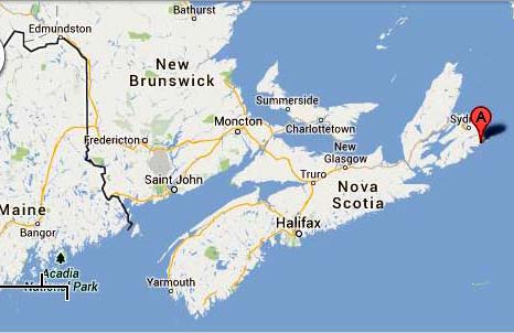 |
| Louisburg is located in the Cape Breton area of Nova Scotia. (Map courtesy Google Maps) |
In 1939, the Department of Transport (DOT) granted the Canadian Navy the use of existing DOT monitoring stations and also gave the RCN access to the DOT HFDF site in Louisburg, Nova Scotia, near Sydney. It's not clear if RCN personnel were used at this station or if DOT operators supplied the bearings.LOW POINT (PORT WAR SIGNAL STATION) , LOW POINT N.S.
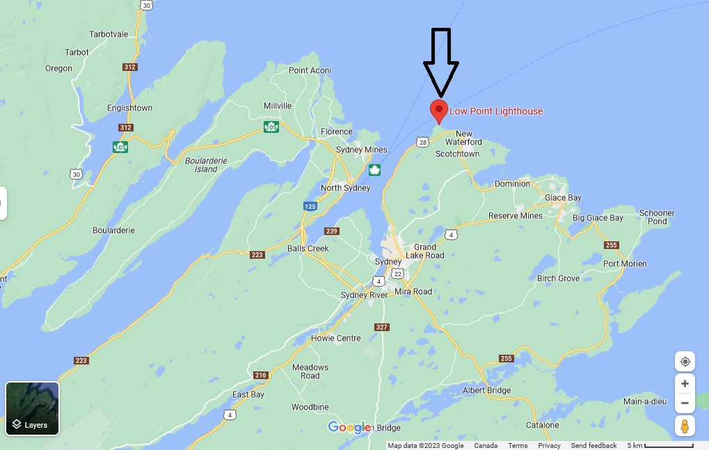
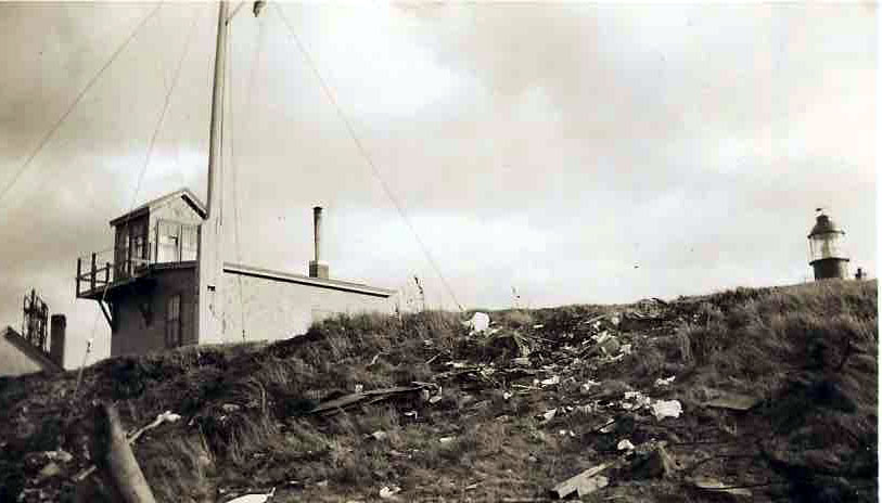
Location of the Low Point Port War Signals Station relative to Sydney N.S.. It is also known as Flat Point. Also located here is the Low Point Lighthouse. . Click on image to enlarge. (Google Maps) Low Point Port War Station with the lighthouse in evidence at the right side of the photo. .(Photo credit unknown) Port War Stations were visual signal stations (flags and lights). Port Wave stations handled radio traffic. Sometimes people get the terms Port War and Port Wave mixed up or use the terms interchangeably, which of course, is incorrect.
MANOTICK, ONTARIO
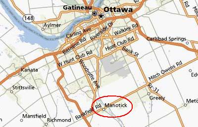 |
| Map courtesy Mapquest |
Manotick was an RCN experimental ionospheric laboratory often referred to as the RPL, or the Radio Propagation Laboratory was located on the Prescot highway. The reason for listing it along with other SIGINT stations was the secrecy of the work."The RPL evolved from Section 6 of the Operational Intelligence Centre (OIC/6) of the Royal Canadian Navy (RCN) during WW II. It originally occupied small huts on the Prescott Highway, which, in the years 1944-47 housed a naval HF radio station, operating under the call sign CFI. The station received and transmitted messages between Naval Service Headquarters, Allied Authorities, ships at sea, and frequently intercepted enemy transmissions. A name plate now marks the site, which is located south of the Experimental Farm's (Ottawa) arboretum, between the Rideau Canal and the Prescott Highway.
During the war, the work of OIC/6 was very directly applied to anti-submarine monitoring and detection problems. Early work was concerned with the application of ionospheric data to communications, detection and direction finding in the HF band. From the outset it was realized that little was known about radio propagation via the ionosphere, and that in the Canadian and North Atlantic latitudes the ionosphere was much more complex and more disturbed than at lower latitudes. Studies of the high latitude ionosphere dominated the research of RPL for more than three decades".It is believed that the Manotick station closed down in the 1970's.
References:
1) Remembrances of a Radio Scientist by John S. Belrose.
http://www.friendsofcrc.ca/Articles/Belrose-EarlyYears/Belrose%20remembrances.html
2) Ralph Cameron <ramcam(at)magma.ca>
 |
| Pennfield NB.. (Map courtesy Google Maps) |
As part of the British Commonwealth Air Training Plan, the construction of an airport to train pilots for WWII action began during the summer of 1940. This RCAF facility, located near St. John NB, also allowed the RCN to use its equipment for HFDF activities. There were four RCN operators at the station.
 |
| Portage La Prairie, Manitoba. (Map courtesy Google Maps) |
RCAF Station Portage la Prairie was part of the British Commonwealth Air Training Plan. The station was controlled by the RCAF but used naval personnel as HFDF operators. The priority was German U-boat activities. This site and the site located at Rivers Manitoba increased the fix accuracy immensely.
RAMSAYVILLE, ONTARIO
 |
| Ramsayville, Ont. (Map courtesy Google Maps) |
RISKE CREEK, BRITISH COLUMBIA
 |
| Riske Creek , BC. (Map courtesy Google Maps) |
Riske Creek is located approximately midway between Kamloops and Prince George BC. The village is the site of one of the earliest ranches in the area owned by a Polish gentleman, L.W. Riskie.# 4 Special Wireless Station was established here in the spring of 1944, and closed in July of the same year without ever becoming operational. It was a huge log building with 14 sleeping rooms on the 2nd floor and six or seven on the main floor. The Lodge had been chosen to house the crew who would build and operate the new station.
The personnel who were designated to staff # 4 Wireless were required to augment the formation of #1 Canadian Special Wireless Group (1CSWG) in Victoria, which deployed to Australia in January of 1945, and returned to Canada on February 26, 1946.
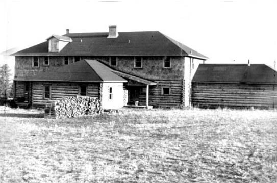 |
| #4 Special Wireless Station at Riske Creek, BC Currently operated as The Historic Chilcotin Lodge. (Image provided by Bill Robinson) |
RIVERS, MANITOBA
 |
| Rivers, Manitoba. (Map courtesy Google Maps) |
The priority of Rivers, Manitoba (slightly north west of Brandon) was German U-boat activity on the East Coast. This site, along with Portage la Prairie when it became operational, immensely increased the fix accuracy on the U-boats. The RCAF agreed that the RCN could provide up to a maximum of four HFDF operators. Ucuelet, Coal Harbour and Alliford Bay, all in British Columbia, were the remaining sites at the disposal of the Navy by the RCAF.
 |
| Rockcliffe is now part of Ottawa. (Map courtesy Google Maps) |
In October 1939 the Canadian Army began their intercept activities. The station was located at the RCAF base in ROCKCLIFFE which is now part of Ottawa.Three Royal Canadian Signals operators (two were brothers) were told to report to the Directorate of Signals office. However, the Directorate was unable to reveal anything about the tasks that they would perform. The Directorate was able to explain that these gifted operators would be given some radio equipment and a room in the basement of the Army HQ Radio Station. A "Restricted Entry" sign would be posted for those who would not be entitled to access the room, and that this new undertaking would be known as "Y".
The initial step for these operators was to become familiar with the activity in the HF band. Then they started to look for subversive and other unusual activities slowly expanding into military targets. They worked twelve hour shifts - twelve hours on, twelve hours off, seven days a week for an eighty four hour week.
A while later, a test site used by the Signals Inspection and Test Department at Rockcliffe became available, allowing operations to be carried out in the basement of the VER building. This structure, originally a garage, became known as the Royal Canadian Signals Experimental Station upon inception of its role in sometime prior to June 1941.
Later, the station was renamed # 1 Special Wireless Station Rockcliffe (# 1 SWS). By this time, twenty-two military operators and two civilian technicians were working from this site. They had definitely outgrown the area afforded by the garage. In 1941, the Army purchased 49 acres of farm land near Leitrim. This site would become the new home of # 1 SWS in 1942..
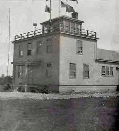
 |
| #1 Special Wireless Station, Ottawa, Ontario. It operated as an Army intercept site from 1939 to 1942, then moved to Leitrim. (Provided by Bill Robinson) |
SHEDIAC, NEW BRUNSWICK
 |
| Shediac, New Brunswick. (Map courtesy Google Maps) |
In 1939, the Department Of Transport (DOT) granted the Royal Canadian Navy the use of existing DOT monitoring stations and including the DOT HFDF site in Shediac, New Brunswick. It is not certain if RCN personnel were used at this station or if DOT operators supplied the bearings.
 |
| St. Hubert, P.Q. (Map courtesy Google Maps) |
The St. Hubert HFDF station near Montreal was civilian controlled and operated. A direct phone line between the site and DOT HQ at Dorval Airport was used to send bearing reports. These reports were copied by an operator at Dorval, who then relayed them to the Canadian Pacific Telegraph office in Montreal. The report would eventually reach NSHQ for processing. This station kept a constant watch on German naval frequencies, mostly 10510 kHz during the day and 4796 kHz during the night, except when the operator was requested, by Dorval to take bearings on aircraft.STRATHBURN, ONTARIO (1939 ·1946)
Strathburn, Ontario. (Map courtesy Google Maps) Strathburn is a small town between London and Windsor Ontario. This DOT owned station was the first one to be used by the Royal Canadian Navy for intercepts. The majority of operators were female but it's not clear if they were military or civilian.
STEVESTON, (LULU ISLAND) BRITISH COLUMBIA
1945(?) to 1945With the end of the war in Europe, a number of operators were moved from Eastern Canada to the West coast. To accommodate the influx, a second DOT monitoring station (in addition to Point Grey) was set up in Steveston BC using the former transmitter building on Williams Road. The station was located in a building that had housed the Point Grey station's transmitters prior to World War II. The Steveston location did not operate independently since it was an annex to the Point Grey signals intelligence station. Operators moved between the two sites as required..
The 68 operators had barely completed KANA code training when the Japanese surrendered and the monitoring service was disbanded. The information in this paragraph comes from Larry Reid's book, "The Story of the West Coast Radio Service" suggests that the Steveston monitoring station was not in existence very long, perhaps early 1945 to the August 15/45 Japanese surrender date.
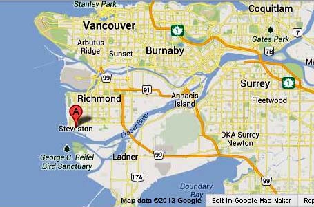 |
| The former town of Steveston is now part of the Greater Vancouver area..(Image courtesy Google Maps) |
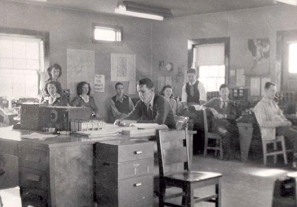
Operations Room Personnel 1945: This was a DOT facility which monitored German and Japanese (Kana code) submarine traffic during WWII. The station was located in a building that had housed the Point Grey station's transmitters prior to World War II. Note the National HRO receiver on the unmanned desk at the left and the coil set next to it. In the very centre of the photo is Art Healey, the station manager. (Photo from Ed Good via Ernie Brown via Laval Desbiens) Steveston operations centre. After 1945 the station was dismantled and the property was eventually redeveloped into a residential neighbour ood, ( Photo provided by Bill Robinson) Steveston, B.C. has been a fishing community (docks, salmon canneries, shipyards, etc.) for over 100 years and is now part of Richmond, a suburb immediately south of Vancouver. The land is very flat since the Richmond is on Lulu Island, an island in the Fraser River delta. Richmond has been home to numerous radio installations over the years.
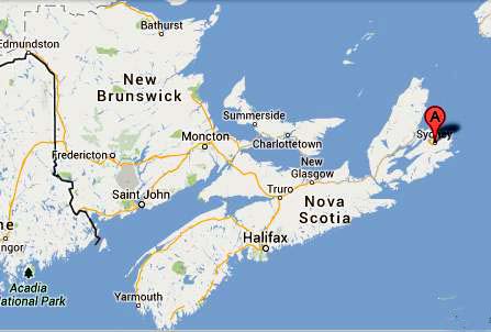 |
| Sydney, Nova Scotia. (Image courtesy Google Maps) |
In 1941, the Royal Canadian Air Force agreed to four RCN telegraphists to work at the RCAF HFDF station during WW II.
 |
| Ucluelet's location on Vancouver Island. (Image courtesy Wikipedia) |
At the outbreak of WW II, a seaplane base was built in Ucluelet (on Vancouver Island) and a land base at Long Beach, which is on the road to Tofino. The road that was started in 1909 and was worked on for 30 years was immediately completed by the government.In 1941, the DF capabilities at RCAF station Ucluelet (Long Beach) were at the disposal of the Royal Canadian Navy. In 1942, RCN operators at Ucluelet, Coal Harbour and Alliford Bay were transferred to Gordon Head in Victoria.
VICTORIA, BRITISH COLUMBIA
During WWII, the Canadian Army carried out "Y" activities from # 3 Special Wireless Station based in Victoria BC.. This unit was responsible for intercepting Japanese Army and Air Force wireless traffic. The station had High Frequency Direction Finding capability in a farmer's field at Nanaimo, about 60 miles northeast of Victoria.
The station was opened sometime in July 1942 then moved to Ladner, BC in 1949.
 |
| #3 Special Wireless station was operated by the Army as an intercept site from 1942 to 1949. After the station was moved to Landau BC, the site was redeveloped into a residential neighborhood. ( Photo provided by Bill Robinson) |
Marjorie Stetson served at #3 Special Wireless Station, Her story can be found here.
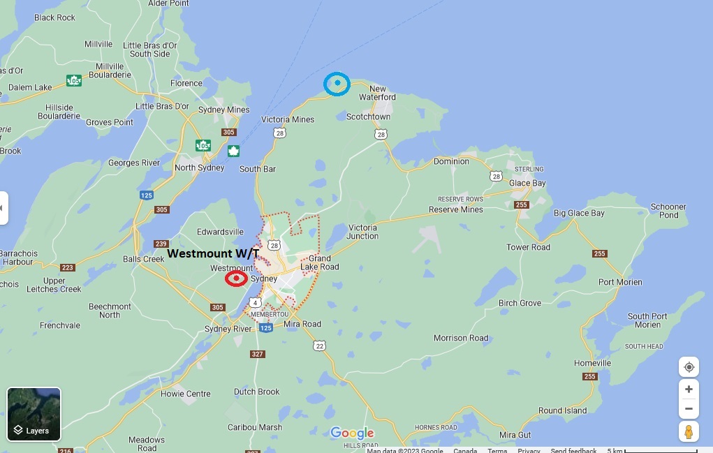 |
| Westmount wireless station (red circle) in relation to Sydney N.S. Click on image to enlarge. The blue circle is the Low Point Port War Signal Station (Google Maps) |
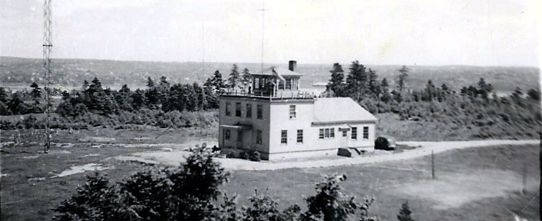 |
| Note the 1940s style car parked at the right side of the building. Can anyone identify the call sign and purpose of the Westmount wireless station in the regional municipality of Westmount located about 10 miles distant from Sydney? Contact: jerry.proc@sympatico.ca |
 |
| The architecture of the building closely resembles the RCN station at Massett BC. Flag and light projector signalling are in evidence. All that's left today is the building's foundation. |
WINNIPEG, MANITOBA
Upon the collapse of France in 1940, the British Admiralty requested that the RCN assume all coverage of French Naval frequencies. All French Naval code and cypher intercepted was forwarded to the Admiralty by cable and Canadian Pacific Railway (CPR) teletype. The preambles and signatures of the messages were coded. Over the years, Winnipeg was responsible for neutral shipping, German shipping and Japanese naval intercept.The RCN in turn, asked DOT for the use of Forrest Manitoba to cover these targets. This site, also known as DOT3, was manned by DOT personnel in May 1942 until relocating to Stevenson Field Winnipeg; about eight miles to the west of the city proper on Whitewold Road. Winnipeg, like other wireless facilities, housed two separate sites; one being the "Y" site, the other a DF site. The "Y" site was DOT operated and controlled, but the DF site was manned by naval personnel.
A visit report expressed the concerns of some DOT operators in regards to their pay at this action. DOTwas paying a bonus of $10 monthly to operators engaged in reading Kana. They considered this unfair as many of the operators who may be quite capable of qualifying, are kept on neutral shipping assignments and thus miss the opportunity to earn the extra money.
Winnipeg ceased providing seven positions to the RCN in June 1945 bemuse of antenna improvements in Gordon Head and the fact that the war was coming to an end.
Credits and References:1) Chelsea photo/copy submitted by Ray White. <legerwhite(at)rogers.com> . Source: Vol 2 of Paul Ozoraks Abandoned Military Installations of Canada.
2) Chelsea copy from: http://friendsofcrc.ca/Articles/Belrose-EarlyYears/Belrose%20remembrances.html
3) Wikipedia http://en.wikipedia.org/wiki/Chelsea%2C_Quebec
4) Copy and photos from Laval Desbiens <desbiens.laval(at)videotron.ca>
5) Steveston description via Tom Brent <tgb(at)telus.net>
6) Bill Robinson <newman-robinson(at)rogers.com>
7) John Gilbert <jgilbert(at)ca.inter.net>
8) Ray White <legerwhite(at)gmail.com>
9) "History of Canadian Communication Electronic Support Measures" (CESM) by S.A. Gray
10) "History of Canadian Signals Intelligence and Direction Finding" by Lynn Wortman and George Fraser.
11) Point Grey info via Tom Brent <navyradiocom(at)gmail.com>
12) Clelsea story http://www.gvhs.ca/publications/utga-wartime.html
13) Frank Statham <f_statham(at)shaw.ca> provided the Coal Harbour photo
14) Maya Moser, <maya.moser(at)ncc-ccn.ca> for Ramsyville.
15 .Canadian Warship Names. Lt. Cdr David J. Freeman CF (Ret'd) .Vanwell Publishing. St. Catherines, Ont. 2000. ISBN 1-55125-048-9.
16) Jean Eiers-Page, Archivist for Prince Rupert <archives(at)citywest.ca>
17) Mac Savage <macsavage(at)shaw.ca >
18) Tom Brent <navyradiocom(at)gmail.com>
19) Michael Shortridge [shortridge.michael@gmail.com]
20) For Posterity's Sake ; Garry [info@forposterityssake.ca]
April 22//23