Click on photo to enlarge
 |
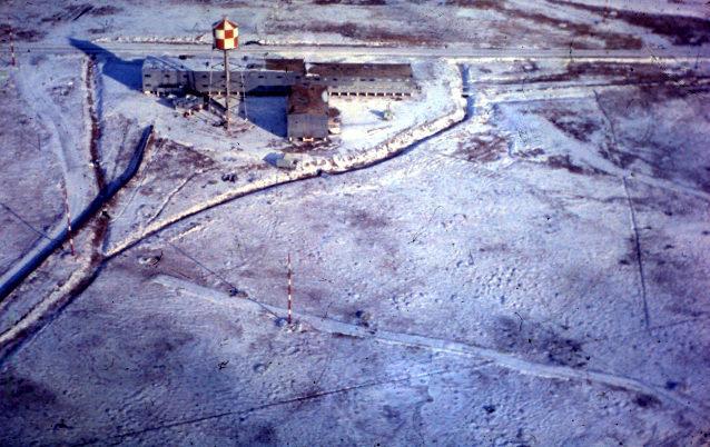
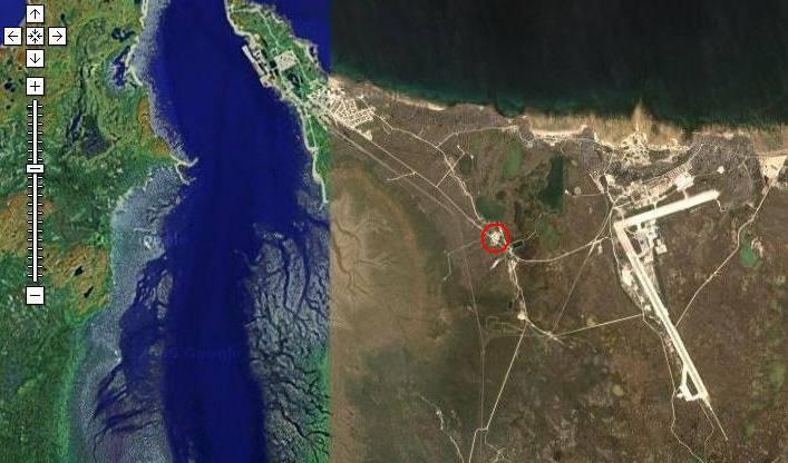
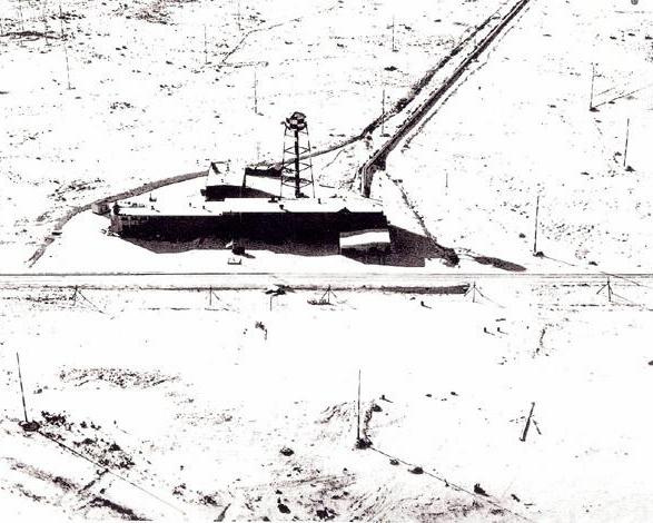
1965 Wide Area Overview: HMCS Churchill
and surrounding vicinity taken on August 14, 1965 using a ZEISS RMK 15/23/0
camera at a focal length of 152 mm. The top of the picture points approximately
north and the red circle marks the Operations Building. The middle of the
photo centers on 58° 44 42N, 94° 06 51W.
Rhombic antennas were located in the fields behind the building on both sides of the operations wing. The fact that the antennas straddled the road was always a contentious one in those days because vehicles passing under the wires would generate ignition noise that interfered with reception. HMC Dockyard Halifax - Antenna Shop was responsible for erecting the antennas at each station. (National Air Library Photo #A1951-27) |
 |
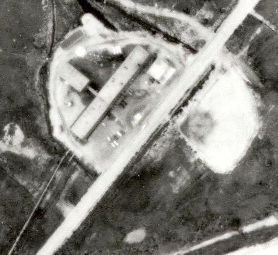
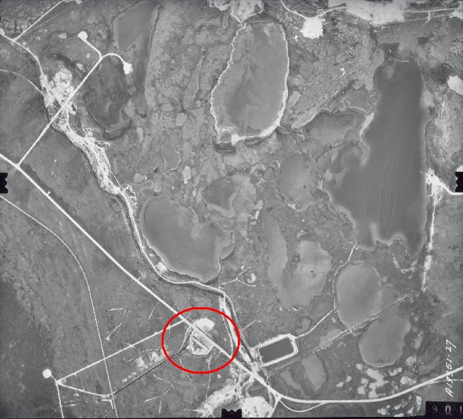
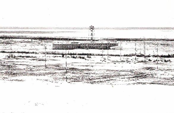
1965 Closeup #1:
1.Operations Building. Note the narrow interconnecting passageway between the buildings. 2. Rhombic antenna arrays consisting of 9 antennas each. The circle
of masts are the feed points for the antennas. Each mast was painted
with 6 red and 5 white rings each.
|
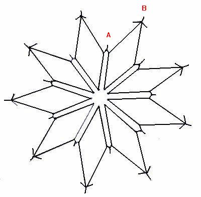 |
Basic rhombic array. This diagram depicts
the basic 9 antenna rhombic array which was found at Churchill, Coverdale
and other SUPRAD sites.
Adjacent sides of the rhombic "diamond" were attached to a common mast and were separated by about 8 feet using insulators. At Churchill, the common mast at point 'A' (typical 9 places) was guyed. Mast 'B' (typical 9 places) at the tip of the apex was also guyed. In the rhombic renderings that follow, it is not possible to show this level of detail. (Image by Jerry Proc) |
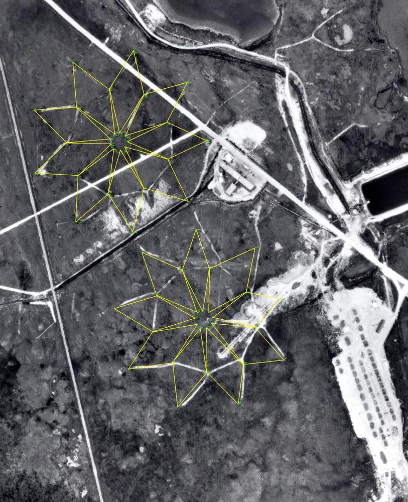 |
1965 Closeup #2 : Rhombic antennas - Two rhombic arrays have been rendered based on mast shadows observed in the photo. A third rhombic array was located across the street from the operations building. See 1965 Closeup #3 for its rendering. (National Air Library Photo #A1951-26) |
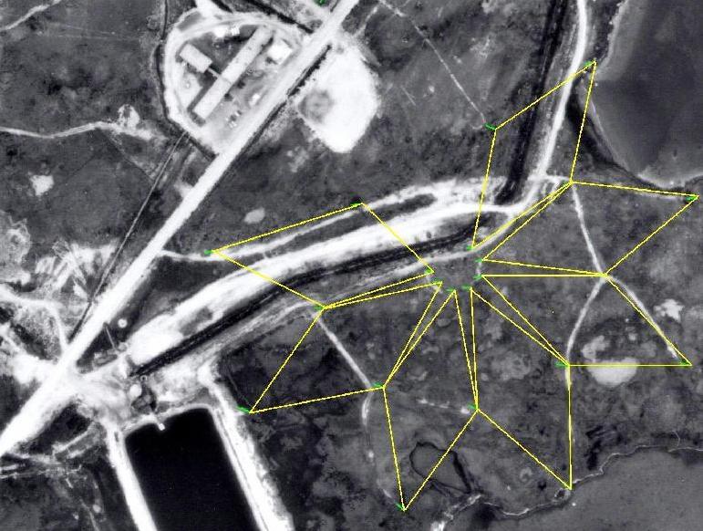 |
1965 Closeup #3 : The rhombic array across from the Operations Building has been rendered and exactly the way it was remembered by Chief Omer LeVasseur, This array only had 7 rhombics rather than the usual nine. In total, there were 25 rhombic antennas at Churchill with a nominal spacing of 13 degrees. (Edited National Air Library Photo #A1951-27) |
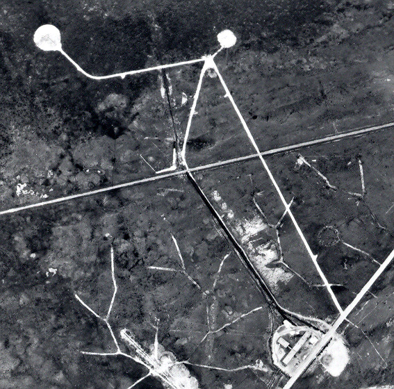 |
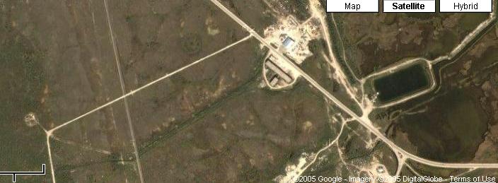
DF Sites (1965) : It is known that Churchill used both the CNF-4 and AN/GRD-501 DF sets.The GRD antenna site, with it's 8 monopoles, is the larger of the two circles. (National Air Library Photo #A1951-27) |
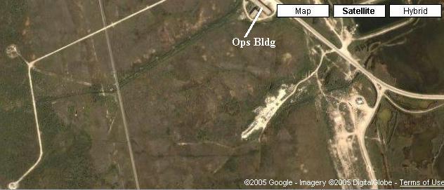 |
DF Sites (2005): Both antenna pads are still evident although one of the access roads seems to have nearly vanished. (Photo courtesy Google Imagery) |
 |
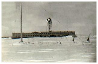
| Low Level Aerial 1: Unfortunately the fresh blanket of snow degrades the contrast in the photos. It was been confirmed that the baseball diamond was already there in 1953 so the photos must be older than that. |
 |
| Low Level Aerial 2: Rowland Fell served in HMCS Churchill from 1965 to 1967. He does not remember the antenna masts across the road from the Ops building as depicted in the photo but believes they were there before the baseball diamond was built. By 1965, there was however, an antenna strung between three masts in that area. It was used by a couple of positions in the Operations Room as a basic directional antenna that was sometimes needed for improved reception. (RCN photo submitted by Doug Stewart) |